Friday, September 26, 2014

September Update


Today concludes week 6 of my student teaching internship at Mascoma Valley Regional High School.  This fall, I am doing 12 weeks of student teaching and working on my portfolio to complete my NH 7-12 Earth/Space science teaching certification. 

I'm learning a lot. That's my sugar-coated way of saying that I have more frustrating days than successful days. I like to be challenged. I always have. This fall has allowed me to realize that not all challenges are equally solvable and not all challenges are fulfilling. 

The Dartmouth part of my program - specifically the grad-level seminar that goes along with student teaching - has been disappointing. It's easier said than done, but I believe that I can have a meaningful experience student teaching despite the lack of support on the Dartmouth end. I am trying to see this as an opportunity to take initiative to push myself, a chance to direct my own learning. So far, this has been much harder than I expected. I have a lot of room to improve on that front.

I'm helping to coach the cross country team, which has been a wonderfully positive experience. It's a small team - only 6 athletes - but a great group of kids. Going to practice is a highlight of a lot of days. I'm very thankful that the team has welcomed me. I'm really proud of how hard the runners work, how supportive they are of one another, and how much each runner has improved since practice began in mid-August. I hope that I can coach again in the future - wherever I might be.


Wednesday, August 13, 2014

Goodbye Colorado!

Yesterday was my last day of the season as a park ranger at Colorado National Monument. I was incredibly lucky to have this experience and I'd like to think I made the most of it. I went on a lot of adventures this summer and met a lot of truly wonderful people. Of course, there are more things I would've liked to do, places I would've liked to see, but I ran out of weekends. I prefer to think of those things as reasons to come back :)


Here are a few highlights:

The Firsts:
• 14,000-footer - Mt. Sneffels
• Raft trip - Lower Animas river, Durango
• Mountain bike trip - Rustler's Loop, Loma
• Road Race at night - Moonlight Miles 10K

Things I won't miss:
• The heat!

Things I will miss:
• Junior rangers. Going through their activity books, presenting them with a badge, and administering the oath was a highlight of every day at the visitor center.


• Meeting park visitors from all over the world
• The beach volleyball+bar that we go to on Friday nights
• Getting to hike during work time - that's pretty hard to beat
• Having a uniform - makes getting dressed for work very easy
• Taco Tuesdays with the maintenance guys
• Grand Junction Rockies single-A baseball games
• The drive to work - check out this color-enhanced photo of my commute:

• Bighorn sheep, lizards, red-tailed hawks, snakes, and scorpions (just kidding about the last two)
• My roommate Angela:

And lastly, I am re-posting a quote that I like a lot and sums up my feelings about this summer.

“If you have not touched the rocky wall of a canyon. If you have not heard a rushing river pound over cobblestones. If you have not seen a native trout rise in a crystalline pool beneath a shattering riffle, or a golden eagle spread its wings and cover you in shadow. If you have not seen the tree line recede to the top of a bare crested mountain. If you have not looked into a pair of wild eyes and seen your own reflection. Please, for the good of your soul, travel west.” 
― Daniel J. Rice, This Side of a Wilderness

Sunday, August 3, 2014

Ranger Programs

This is the Bookcliffs View Shelter where rangers lead evening programs on Friday and Saturday nights in the summer. The programs go from 7:30 to 8:30ish, just perfect to watch a colorful summer sunset.


I've led the evening program a few times this summer. We have the freedom to talk about whatever we want. After a lot of reading, I've created a three part evening program that I've developed and improved over the course of the summer. 

First, I talk about general history of the monument, the important characters in its history, and early efforts to build a road. I've learned a lot about the building of Serpent's Trail - the first auto road in the monument. After that, I go into the geologic story of the canyons as it pertains to road building and because I think it's fascinating (rock nerd). Then I return to the story of the road, and go into the construction of Rim Rock Drive. I talk about FDR, the Civilian Conservation Corps, and the backbreaking labor that went into building the 23 mile road along the top of the canyons through the monument. 

I've been fascinated by the CCC since I learned about the legacy of their work during a memorable ranger program at Phantom Ranch when I was in high school. I've really enjoyed researching and reading accounts of life in the CCC camps during the 1930s, going through old photographs, and meeting children of CCC enrollees. I hope that through my programs, I can spark interest in this piece of American National Parks history just like that ranger at the bottom of the Grand Canyon did for me.


Friday, August 1, 2014

14,000


I had the best long weekend. Saturday, I had dinner in Ouray and swam in the hot springs before camping in a basin surrounded by breathtaking mountains. 

Sunday, I went rafting on the lower Animas river in Durango and explored silverton. 

Monday, we hiked to the summit of Mt. Sneffels at 14,157'. It was my first 14er, and fittingly we met a guy on top who has hiked all 58 of them. 

Here's a few photos from the hike.

This is me hiking (scrambling) up the very steep trail. Just above this, we hiked through a 200 yard section of snow. 

I made it! Even if I wasn't quite ready for the photo...

Here's my hiking partner on the summit. I accidentally beheaded him, but still a neat pic. 


The Baja at the trailhead in Yankee Boy Basin. Adventure car. 

Tuesday, July 15, 2014

Traveling with the Family

Last Monday, I drove to Dillon, CO, to meet up with my aunt, who's spending the summer there. My parents and brother flew into Denver and arrived in Dillon on Monday afternoon as well. Dillon, about an hour west of Denver, has the unique combination of a beautiful lake and views of snow-capped mountains. Absolutely gorgeous. And for me, the higher elevation provided a well-needed break from the scorching heat of Grand Junction (which hit 100 twice while I was in Dillon!).

Here are some photos from Dillon.


The amphitheater where there are free concerts several times each week.

And here's the family in front of Lake Dillon.

On Tuesday, we drove scenic roads through the mountains to Boulder, where we explored the walking downtown of Pearl Street. We also walked around the University of Colorado Boulder campus. Very impressive. Here's a view of the flowers on Pearl Street.


After that, we made the short drive over to Denver where we watched a Colorado Rockies game at Coors Field. My family went to a game there when they visited Colorado in 2009, but I was working as a camp counselor and didn't make the trip. I feel lucky that it worked out for me to join them this time around.


Our seats were unreal. We sat in the second row behind the visiting team dugout. And one of us was lucky enough to even get a ball :)


Sunday, July 13, 2014

4th of July

I had to work on the 4th of July. Before you feel bad for me, let me explain.

On July 4, 1911, Colorado National Monument's first park ranger, John Otto, climbed to the top of Independence Monument and raised an American flag, which could be seen all across the canyons of Colorado National Monument. Climbers have continued this tradition for more than 100 years. In recent years, the local search and rescue team has led the climbing trip, and park visitors gather in the canyon and at the overlook to watch. Here's a little more info about the tradition: http://www.nps.gov/colm/historyculture/freedom-flies-high.htm

Another ranger and I worked at a tent at the Independence Monument Overlook. We set up spotting scopes to watch the climbers, handed out little flags, and answered questions about the monument, the tradition, and John Otto. It was a blast watching the climbers ascend and talking with incredulous visitors. There was even a news crew from Denver that came to cover the event. I really enjoyed seeing the foreign visitors waving their American flags.

Here's a photos of our tent at the overlook.


They made it! It wasn't very windy, but you can see the flag up on top. You can see some of the steps that John Otto carved into the sandstone going up the right side to the top. Click the photo enlarge.


Sunday, June 29, 2014

Independence Monument


I went hiking in Monument Canyon, home to many of the spectacular monoliths for which Colorado National Monument is known. The most iconic is called Independence Monument, shown below. It's a red-sandstone rock tower standing at roughly 450 feet, the last piece of an ancient canyon wall that has collapsed a little at a time over the last few million years.

A little bit of history: John Otto is the guy who relentlessly pushed for Colorado National Monument to be set aside as a park in the early 1900s. Some call him a free-spirit, but most say he was a total nut. He lived in the canyons by himself for close to a decade, got married in the canyon now named Wedding Canyon (it didn't last), and sent a lot of letters to the White House arguing for this area to be protected. In 1911, President Taft officially signed for the Monument, and Otto became the park's first official custodian. 

Otto created the first route up Independence Monument, carving steps and even drilling holes into which he put iron bars. The bars have since been removed for safety reasons, but the steps are still used by climbers today. Otto used to climb up with an American flag and fly it on top of the tower. The tradition has continued, and on the 4th of July the local Search and Rescue team leads climbers up with a flag and apparently people hike in to the base to watch and cheer for them. I'm looking forward to seeing it on Friday!


I happened to notice some climbers while I was eating a snack at the base of Independence. This is a picture of the climbers with my camera on maximum zoom. They are WAY up there. 


After watching for a while, I kept hiking up the canyon. Once I got up a little higher, I looked back and you could see two little tiny dots up on top. You can click on the photo to enlarge it. They made it!


Check out some more photos of climbers on this site: http://www.supertopo.com/rock-climbing/Desert-Towers-Independence-Monument-Ottos-Route

Monday, June 23, 2014

Hiking on the Grand Mesa

Yesterday I drove up to the Grand Mesa, about an hour from where I live in Fruita. According to the GPS, I parked above 11,000 feet and it was all uphill from there.

I hiked the Crag Crest Trail, in the Grand Mesa National Forest. The hike was awesome - about 2 miles are along an exposed ridge where you can see many miles in every directions. Here are a few photos from my hike. You can read more about where I was here: http://www.gjhikes.com/2010/07/crag-crest-loop.html


 Yes -- there were places where I had to go around snow drifts. But it wasn't cold - I hiked in shorts and a t-shirt.


Saturday, June 21, 2014

Canyons & Lizards!

This week was training for my role as an interpretive ranger this summer. Once I'm in the regular rotation, days will consist of giving short talks (geology talks in the morning, various presentations in the afternoon, or evening programs in the campground), staffing the information desk in the visitor center, or roving the trails to provide more informal interpretation. Yes - roving means I get to go hiking during work time.

Here are a few highlights from week one:

• Wednesday afternoon, I drove the entire park, 23 miles, along historic Rim Rock Drive, which follows the rim of the canyons. I stopped at all the overlooks, read all the signs, and talked with park visitors. In all, the drive took me about 3.5 hours. This is called Coke Ovens because the rocks have eroded to look like the dome-shaped ovens used to turn coal into coke in the olden days.


• I helped with the kids program that comes to visit the monument on Thursday mornings. The kids are part of a day camp at local elementary schools. Their program included learning about what the park service does, why Colorado National Monument was set aside to be preserved, and a short hike to Devil's Kitchen. I really enjoyed hanging out with the kids and look forward to doing it again in future weeks. This is the picnic area where the kids program meets.


• After the kids left to go back to camp, I stayed and hiked some of the east-side trails. So far, my favorite is a trail called No Thoroughfare Canyon. The trail follows a dry stream bed to a (dry) waterfall. The trees in the canyons are so cool - they are well adapted for the desert, and they need to be. The monument only gets about 9 inches of precipitation per year. Compare that to the +/- 140 inches of precipitation each year in Hanover.


Here's the waterfall.

And here's one of the many colorful lizards I spotted along the trail. There are two kinds of lizards in the monument. This one is a Collared lizard, as you can tell by the incredible colors around his neck.


• Thursday night I went to the weekly outdoor concert on the green in Fruita, just three blocks from where I'm living. Hundreds of people were there listening to the band -- pretty cool!

• Last night, I co-led the evening ranger program in the campground. For my segment, I told the story of how Rim Rock Drive was built almost entirely by hand by men in FDR's Civilian Conservation Corps between 1933-1942. I enjoyed researching it and learned a lot about the history of the monument. You can read about the road here: http://www.nps.gov/colm/planyourvisit/scenic-rim-rock-drive.htm

After work, I met some of the seasonal rangers and other GeoCorps interns at a bar/restaurant in Grand Junction that has sand volleyball courts. Sounds goofy, but it was a lot of fun.

I'm off to see a Grand Junction Rockies game, then going hiking tomorrow morning!

Sunday, June 15, 2014

Howdy from Fruita, Colorado!

What a wild week it has been! Last Sunday, I graduated from Dartmouth and feel very fortunate to get to share that day will family. After driving most of the way across the country with my dad, I’ll start work as an interpretive ranger at Colorado National Monument tomorrow. 

Here are some notes from the trip and photos of the very cool place where I’m spending the summer.

Tuesday, my dad and I headed out early in the morning to make the 2,255 mile drive to western Colorado. We packed the fake-truck full with clothes, hiking gear, and my bike in the back. We camped along the way, spending nights in Homerville, Ohio, Oak Grove, Missouri, and Central City, Colorado. Huge thanks to my dad for tolerating my recovery from a sleep-deprived senior week combined with my unmatched ability to sleep in the car. It was an awesome road trip.

One highlight was reaching the Rocky Mountains. After spending nearly a whole day looking at Kansas flatness, this view, just west of Denver, was a jaw-dropper. 


My favorite sign on I-70 on a seriously long, steep downhill:


And the view from our campground on the third night:


With a little extra time, we stopped in a few neat little towns in the mountains along I-70 on the drive through the Rockies. We arrived in Grand Junction in early afternoon, so we walked around main street and got lunch before heading ten miles farther west to Fruita, where I am living for the summer. With a shortage of housing in the park, the GeoCorps program set me up with a house in the neighboring town, living with another seasonal intern. I feel lucky that it worked out this way, because the town is great - a nice walking downtown, restaurants with outdoor seating, a library and pool.

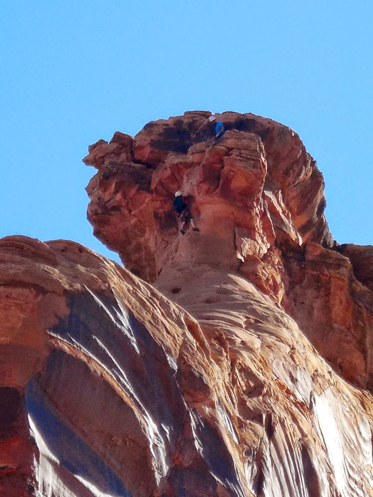
Friday afternoon, we drove to the visitor center in Colorado National Monument and we were stunned. First, the drive is harrowing. The road curves around switchbacks up the side of steep red rock cliffs. Second, the views are stunning. From the road, you can see all the way across the Grand Valley to the mountains on the other side. It’s hard to believe that this place isn’t more widely-known.


On Saturday, I brought my dad to the Grand Junction train station, where he caught the California Zephyr to Denver to fly back home. It was tough to say goodbye, but I’ve got a lot to look forward to this summer. Since then, I’ve done some exploring of the area, grocery shopping, and hiking. Saturday night, I attending a very impressive ranger program in the campground on the Colorado night sky. Nick, the ranger who led the program, is the person who hired me for this job. Unfortunately for me, he got a new job at another national park, and is leaving this week. 

After his program, we set up a big telescope and looked at Venus, Saturn, and the rising almost-full-moon over the canyon. Nick pointed out constellations, shared stories of the stars, and tales of his time as a ranger. It was an amazing way to spend a night and a phenomenal introduction to my summer job.

This morning, I hiked Serpents Trail, which follows the route of the original car road up the monument. The road was built in the early 1900s and — according to the signs — the fuel pumps in cars were not powerful enough to push them up the steep inclines of the road, so they had to drive up it backwards so that the fuel pumps went along with gravity! The road went out of use in the 1950s when Rim Rock Drive was completed as a project of the Civilian Conservation Corps.


Here's the view from the top:


That’s all for now. Not sure how frequently I'll be able to update this, because I don't have wifi at the house, but check back sometime for more stories and photos. First day of work tomorrow!


“If you have not touched the rocky wall of a canyon. If you have not heard a rushing river pound over cobblestones. If you have not seen a native trout rise in a crystalline pool beneath a shattering riffle, or a golden eagle spread its wings and cover you in shadow. If you have not seen the tree line recede to the top of a bare crested mountain. If you have not looked into a pair of wild eyes and seen your own reflection. Please, for the good of your soul, travel west.” 
― Daniel J. Rice, This Side of a Wilderness

Saturday, January 11, 2014

Hawaii - The Big Island

This December, I was one of 9 lucky undergrads chosen to travel to the Big Island of Hawaii through the Dartmouth Earth Sciences department. Before the trip, we met for several night classes to learn about the regional geology, study how hot spots form, and the basics of volcanology.

We spent the first three days on the Kona side (the western side) of the Island, where the weather is consistently high 70s and sunny. Not too shabby.


The first day we went hiking near the northern coast, where the volcanoes are no longer active. The coast is a series of U-shaped valleys, making for some pretty serious hiking. Despite what it looks like in this photo, we had beautiful blue skies each day on the Kona side.


The sunsets over the ocean were one of my favorite parts of the trip. 


The next day we drove to the summit of Mauna Kea (13,803 ft). There are a number of astronomical observatories conveniently located at the top, where they are not subject to clouds. We were looking down on the clouds. It was really cool to see these facilities after learning about the Keck and others in my astronomy class last fall.


On the drive back down, some of us stopped to hike out to a glacial lake on the side of the volcano. It's wild to think about glaciers in Hawaii, but it happened.


Then we drove around the South Point of the Island, stopping to hike out to an amazing green sand beach. I'd never seen anything like it. The green sand is made up of Olivine, the first mineral to crystallize as magma cools. When all the ash and other particles, which are less dense, are washed out to sea, the olivine are left behind. 


We arrived at our new rental houses in the small town of Volcano (on the eastern side) and that night we drove to the visitor center where you can see the glow of an active lava lake. Pretty scary to think about what's going on under the ground where we were standing...


We hiked down through the Kilauea Iki caldera, which was active as recently as the late 1950s.


In some places, the steam vents are still visible. It was a little freaky to think about what was going on under the rocks we stood on.


This 2003 lava flow permanently closed a coastal state-highway road. This is the first time I've touched rocks that were younger than I am. 


We learned a lot about volcanoes and the geology of Hawaii, but we also had a lot of fun. Here's a photo of science in action :)